Файл:GeneralMapOfDistancesAndHistoricCapitals.jpg
Перейти до навігації
Перейти до пошуку
Розмір при попередньому перегляді: 744 × 599 пікселів. Інші роздільності: 298 × 240 пікселів | 596 × 480 пікселів | 953 × 768 пікселів | 1271 × 1024 пікселів | 2542 × 2048 пікселів | 3493 × 2814 пікселів.
Повна роздільність (3493 × 2814 пікселів, розмір файлу: 6,14 МБ, MIME-тип: image/jpeg)
| Відомості про цей файл містяться на Вікісховищі — централізованому сховищі вільних файлів мультимедіа для використання у проектах Фонду Вікімедіа. |
Опис файлу
Ліцензування
|
Це зображення (чи мультимедійний файл) перебуває в суспільному надбанні у всьому світі через те, що термін охорони закінчився (минуло 70 років з дня смерті автора або з моменту першої публікації).
Таким чином, ця репродукція також перебуває в суспільному надбанні. Це стосується репродукцій, створених у США (див. справу Bridgeman Art Library v. Corel Corp.), Німеччині та багатьох інших країнах.
| ||||
Історія файлу
Клацніть на дату/час, щоб переглянути, як тоді виглядав файл.
| Дата/час | Мініатюра | Розмір об'єкта | Користувач | Коментар | |
|---|---|---|---|---|---|
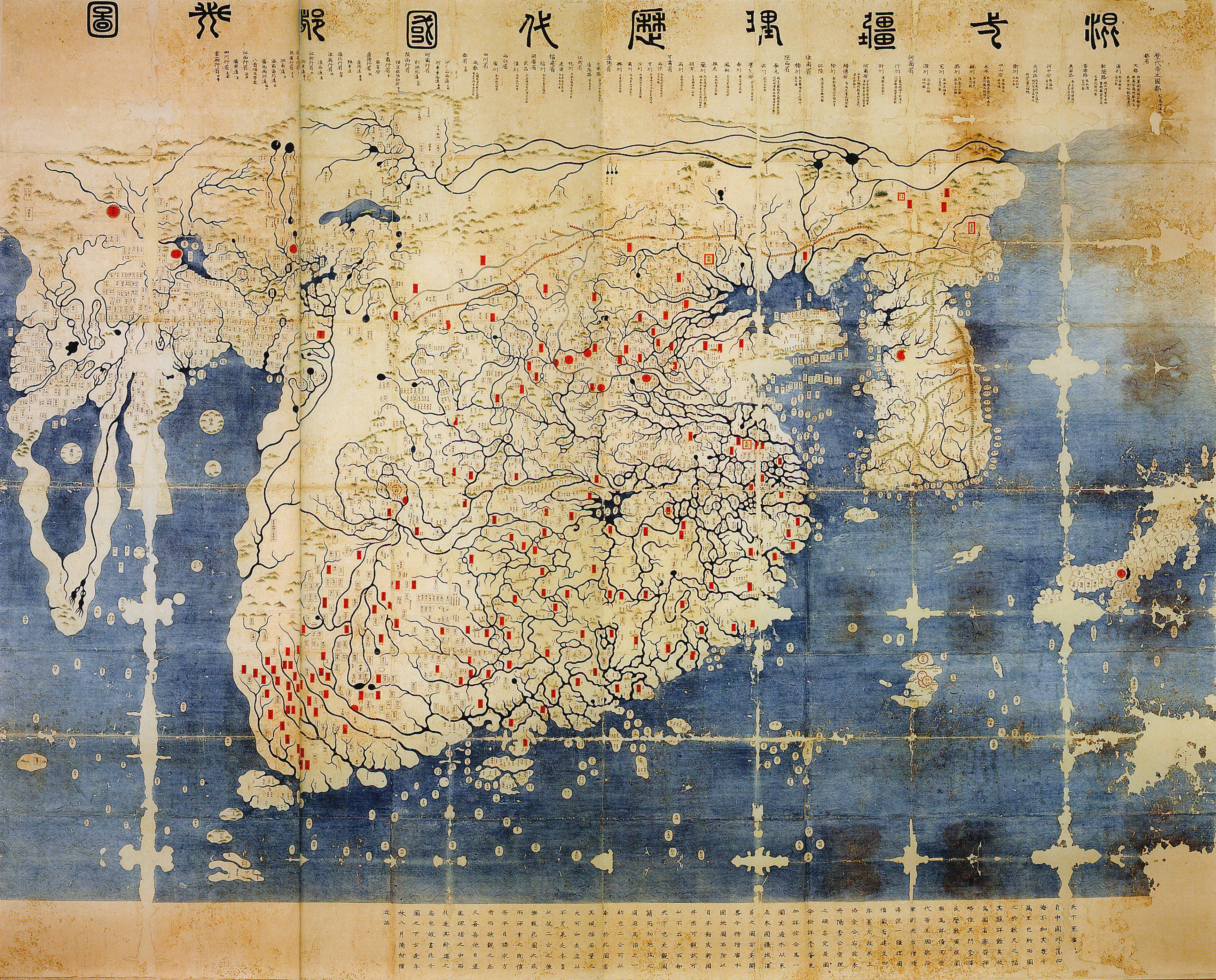
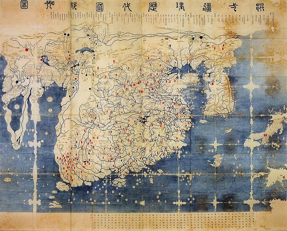
| поточний | 14:40, 11 червня 2008 | | 3493 × 2814 (6,14 МБ) | Yaan | == Summary == {{Information |Description = General map of the distances and the historic capitals (chinese: Hunyi jiangli lidai guodu zhi tu; japanese: Kon'itsu kyoori rekidai kokuto no zu), Korea, roughly 1470. Ink and paint on paper. Height 220 cm, widt |
Використання файлу
Такі сторінки використовують цей файл:
Глобальне використання файлу
Цей файл використовують такі інші вікі:
- Використання в en.wikipedia.org
- Використання в fr.wikipedia.org
- Використання в fr.wikiversity.org
- Використання в ko.wikipedia.org
- Використання в ru.wikipedia.org
- Використання в www.wikidata.org
- Використання в zh.wikipedia.org