Файл:Mannerheim studying a map.jpg
Перейти до навігації
Перейти до пошуку
Нема версії з більшою роздільністю.
Mannerheim_studying_a_map.jpg (300 × 232 пікселів, розмір файлу: 17 КБ, MIME-тип: image/jpeg)
| Відомості про цей файл містяться на Вікісховищі — централізованому сховищі вільних файлів мультимедіа для використання у проектах Фонду Вікімедіа. |
| Опис |
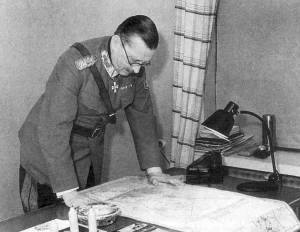
English: Marshal of Finland Carl Gustaf Emil Mannerheim studyding a map. Suomi: Marsalkka Carl Gustaf Emil Mannerheim tutkimassa karttaa. |
| Джерело | http://www.mil.fi/paaesikunta/paaesikunta/historia/sota.dsp |
This photograph is in the public domain in Finland, because either a period of 50 years has elapsed from the year of creation or the photograph was first published before 1966. The section 49a of the Finnish Copyright Act (404/1961, amended 607/2015) specifies that photographs not considered to be "works of art" become public domain 50 years after they were created. The 50 years from creation protection period came into force in 1991. Before that the protection period was 25 years from the year of first publication according to the §16 of the law of protection of photographs of 1961. Material already released to public domain according to the 1961 law remains in public domain, and therefore all photographs (but not photographic works of art) released before 1966 are in the public domain. See Commons:Copyright rules by territory/Finland for details.
If you think this picture should be considered a work of art, nominate it for deletion. To uploader: Please provide where the image was first published and who created it. The material with this copyright tag should not be used on the German-language Wikipedia. See Talk page of this template.
|
Історія файлу
Клацніть на дату/час, щоб переглянути, як тоді виглядав файл.
| Дата/час | Мініатюра | Розмір об'єкта | Користувач | Коментар | |
|---|---|---|---|---|---|
| поточний | 11:53, 28 березня 2015 | | 300 × 232 (17 КБ) | Hohum | Greyscale |
| 18:37, 23 жовтня 2005 |  | 300 × 232 (12 КБ) | Hautala | Marshal of Finland Carl Gustav Emil Mannerheim studyding a map. Image downloaded from [http://www.mil.fi/paaesikunta/paaesikunta/historia/sota.dsp]. |
Використання файлу
Така сторінка використовує цей файл:
Глобальне використання файлу
Цей файл використовують такі інші вікі:
- Використання в ast.wikipedia.org
- Використання в az.wikipedia.org
- Використання в ca.wikipedia.org
- Використання в cs.wikipedia.org
- Використання в da.wikipedia.org
- Використання в eo.wikipedia.org
- Використання в es.wikipedia.org
- Використання в fi.wikipedia.org
- Використання в he.wikipedia.org
- Використання в hr.wikipedia.org
- Використання в ja.wikipedia.org
- Використання в ko.wikipedia.org
- Використання в no.wikipedia.org
- Використання в ru.wikipedia.org
- Використання в sv.wikipedia.org
- Використання в th.wikipedia.org
- Використання в tr.wikipedia.org