Файл:Jewel-Toned Lakes of the Qinghai-Tibet Plateau.jpg
Перейти до навігації
Перейти до пошуку

Розмір при попередньому перегляді: 615 × 600 пікселів. Інші роздільності: 246 × 240 пікселів | 492 × 480 пікселів | 788 × 768 пікселів | 1050 × 1024 пікселів | 2101 × 2048 пікселів | 7940 × 7740 пікселів.
Повна роздільність (7940 × 7740 пікселів, розмір файлу: 7 МБ, MIME-тип: image/jpeg)
| Відомості про цей файл містяться на Вікісховищі — централізованому сховищі вільних файлів мультимедіа для використання у проектах Фонду Вікімедіа. |
| Попередження | У деяких браузерах можуть виникнути проблеми при перегляді цього зображення у повній роздільності: це зображення має дуже велику кількість пікселів і може завантажитись зі спотвореннями, або спричинити зависання браузера. |
|---|
Опис файлу
| Опис |
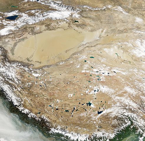
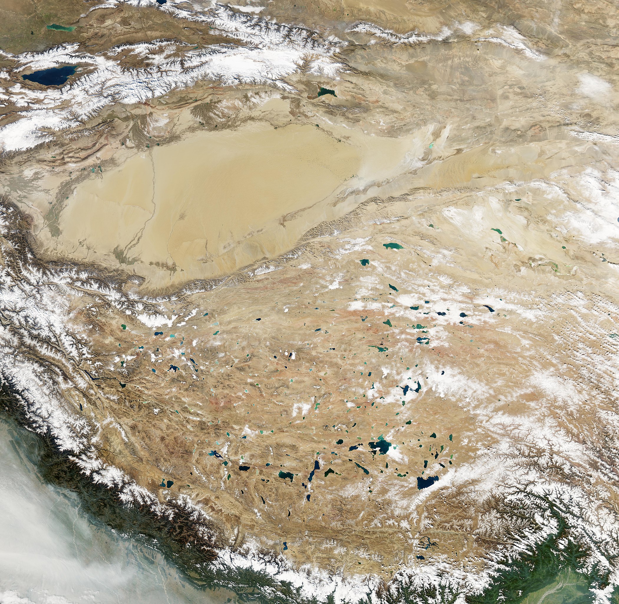
English: Natural-colour image of the Tibetan Plateau. The Qinghai-Tibet Plateau not only gives rise to most of Asia’s major rivers, it also holds a constellation of salt- and freshwater lakes. Due to differences in depth, sediments, and microscopic organisms in the various lakes, they collectively present a myriad of greens, blues, and teals when viewed from above. Resembling bits of abalone shell, the lakes glimmer in assorted jewel tones. The lakes in this region typically lack outlets, allowing the accumulation of minerals that, combined with other features, influence lake colour. The lakes vary widely in surface area and shape. Two of the largest in this scene are Siling Co and Nam Co. One of the most irregularly shaped lakes is Ngangla Ringco.
Nam Co ranks among the world’s highest-altitude salt lakes, with a lake surface at 4,718 meters. It measures roughly 79 by 25 kilometres and, except for areas along the south-western and north-eastern margins, the lake appears nearly uniform blue. Siling Co’s shape and colour vary more than Nam Co’s. The lake’s blue-green hue ranges from light (in the north and east) to dark (in the south and west). Fringing the lake are smaller water bodies, which all used to be part of a larger lake. Lying to the west, Ngangla Ringco is one of the most unusually shaped water bodies on the Qinghai-Tibet Plateau, with colours ranging from turquoise to sapphire. Small islands dot the surface in the west, and a large island sits in the lake’s eastern half. |
| Час створення | |
| Джерело | NASA Earth Observatory |
| Автор | Jesse Allen |
Image captured by the Moderate Resolution Imaging Spectroradiometer (MODIS) on NASA’s Aqua satellite. Data obtained from the Goddard Level 1 and Atmospheric Archive and Distribution System (LAADS).
Ліцензування
| Цей файл перебуває у суспільному надбанні, оскільки він був створений NASA (Національним управлінням з аеронавтики і дослідження космічного простору). Згідно з політикою NASA стосовно авторського права, «матеріали NASA не захищаються авторським правом, якщо не вказано протилежне». (Див. Template:PD-USGov, сторінку політики NASA стосовно авторського права, або політику використання зображень JPL.) | ||
 |
Попередження:
|
| Анотації | Це зображення має анотації: Переглянути анотації на Вікісховищі |
Історія файлу
Клацніть на дату/час, щоб переглянути, як тоді виглядав файл.
| Дата/час | Мініатюра | Розмір об'єкта | Користувач | Коментар | |
|---|---|---|---|---|---|
| поточний | 13:22, 26 січня 2013 | | 7940 × 7740 (7 МБ) | Slick-o-bot | Bot: convert to a non-interlaced jpeg (see bug #17645) |
| 10:33, 26 листопада 2010 |  | 7940 × 7740 (6,88 МБ) | Originalwana | {{Information |Description={{en|1=Natural-colour image of the Tibetan Plateau. The Qinghai-Tibet Plateau not only gives rise to most of Asia’s major rivers, it also holds a constellation of salt- and freshwater lakes. Due to differences in depth |
Використання файлу
Така сторінка використовує цей файл:
Глобальне використання файлу
Цей файл використовують такі інші вікі:
- Використання в ast.wikipedia.org
- Використання в bo.wikipedia.org
- Використання в ca.wikipedia.org
- Використання в de.wikipedia.org
- Використання в en.wikipedia.org
- Використання в es.wikipedia.org
- Використання в sl.wikipedia.org
- Використання в sr.wikipedia.org