Шаблон:Округ США: відмінності між версіями
Перейти до навігації
Перейти до пошуку
| [неперевірена версія] | [неперевірена версія] |
Вилучено вміст Додано вміст
Створена сторінка: {{#if:{{{lat deg|}}}| {{#if:{{{long deg|}}}| {{coord|{{{lat deg}}}|{{{lat min|0}}}|N|{{{long deg}}}|{{{long min|0}}}|W|type:adm2nd_region:US-{{StateAbbr|{{{state}}... |
Немає опису редагування |
||
| Рядок 17: | Рядок 17: | ||
! colspan="2" style="text-align:center" {{!}} [[Motto]]: {{{motto}}} }} |
! colspan="2" style="text-align:center" {{!}} [[Motto]]: {{{motto}}} }} |
||
|- class="mergedrow" |
|- class="mergedrow" |
||
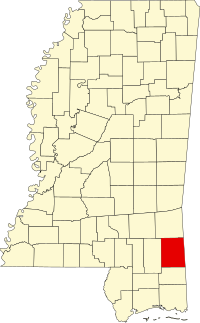
|colspan="2" style="text-align: center;"| [[File:Map of {{{ |
|colspan="2" style="text-align: center;"| [[File:Map of {{{english_state}}} highlighting {{{english_county}}}.svg|{{#switch:{{{state}}}|New Hampshire=110|Alabama|Delaware|Mississippi|New Jersey|Vermont=120|Idaho|Illinois|Indiana|Maine|Nevada=130|Ohio=180|200}}px|Map of {{{english_state}}} highlighting {{{english_county}}} ]]<br><small>Location in the state of {{#switch:{{{state}}} |
||
| Georgia = [[Georgia (U.S. state)|Georgia]] |
| Georgia = [[Georgia (U.S. state)|Georgia]] |
||
| Washington = [[Washington (U.S. state)|Washington]] |
| Washington = [[Washington (U.S. state)|Washington]] |
||
| Рядок 72: | Рядок 72: | ||
| West Virginia = WV.svg |
| West Virginia = WV.svg |
||
| Wisconsin = WI.svg |
| Wisconsin = WI.svg |
||
| |
| Вайомінг = WY.svg |
||
| ERROR, wrong state name. looking for Map of USA XX.svg where XX is the two-letter abbreviation of the state}} | Map of the USA highlighting {{{state}}}|200px|Map of the U.S. highlighting {{{state}}}]]<br><small>{{{state}}}'s location in the [[United States|U.S.]]</small> |
| ERROR, wrong state name. looking for Map of USA XX.svg where XX is the two-letter abbreviation of the state}} | Map of the USA highlighting {{{state}}}|200px|Map of the U.S. highlighting {{{state}}}]]<br><small>{{{state}}}'s location in the [[United States|U.S.]]</small> |
||
|- |
|- |
||
Версія за 16:56, 2 червня 2011
| {{{county}}}, {{{state}}} | |
| [[File:Map of {{{english_state}}} highlighting {{{english_county}}}.svg|200px|Map of {{{english_state}}} highlighting {{{english_county}}} ]] Location in the state of [[{{{state}}}]] | |
| Map of the U.S. highlighting {{{state}}} {{{state}}}'s location in the U.S. | |
| Founded | information needed |
|---|---|
| Seat | |
| Area - Total - Land - Water |
, |
| Population - Density |
|
Використання
{{Округ США
 |county           = округ
 |english_county   = округ англійською
 |state            = штат
 |english_state    =
 |seal             = печатка
 |map              = мапа
 |map size         = розмір мапи
 |founded          = засновано
 |seat             = центр округу
 |largest city     = найбільше місто
 |area_total_sq_mi = загальна площа
 |area_land_sq_mi  = площа суші
 |area_water_sq_mi = площа водна
 |area percentage  =
 |census yr        = рік перепису
 |pop              = населення
 |density_km2      = щільність населення
 |web              = інтернет сторінка
 |ID               = ідентифікатор округу
 |US_ID            =
}}
| Округ Ґрін, Міссісіпі | |
 Location in the state of Міссісіпі | |
| Map of the U.S. highlighting Міссісіпі Міссісіпі's location in the U.S. | |
| Founded | 1811 |
|---|---|
| Seat | Ліксвілл |
| Area - Total - Land - Water |
719 sq mi (1862 km²) 713 sq mi (1847 km²) 6 sq mi (16 km²), 0.83 % |
| Population - (2000) - Density |
13 299 18/sq mi (7,1/km²) |
Приклад використання
{{Округ США
 |county           = Округ  Ґрін
 |english_county   = Greene County
 |state            = Міссісіпі
 |english_state    = Mississippi
 |seal             =
 |map              = Map of  Mississippi  highlighting Greene County.png
 |map size         = 250
 |founded          = 1811
 |seat =           = [[Ліксвілл (Міссісіпі)|Ліксвілл]]
 |largest city     =
 |area_total_sq_mi = 719
 |area_land_sq_mi  = 713
 |area_water_sq_mi = 6
 |area percentage  = 0.83 %
 |census yr        = 2000
 |pop              = 13299
 |density_km2      = 7.1
 |web              =
 |ID               = 28041
 |US_ID            = 05000US28041
}}
Див. також
| Документація вище включена з Шаблон:Округ США/документація. (ред. | історія) Дописувачі можуть експериментувати на підсторінках пісочниця (створити | дзеркало) та тести (створити) цього шаблону. Будь ласка, додавайте категорії до підсторінки /документація. Підсторінки цього шаблону. |