Файл:Maricopa County Incorporated and Planning areas SRPMIC highlighted.svg
Перейти до навігації
Перейти до пошуку

Розмір цього попереднього перегляду PNG для вихідного SVG-файлу: 694 × 599 пікселів. Інші роздільності: 278 × 240 пікселів | 556 × 480 пікселів | 889 × 768 пікселів | 1185 × 1024 пікселів | 2371 × 2048 пікселів | 940 × 812 пікселів.
Повна роздільність (SVG-файл, номінально 940 × 812 пікселів, розмір файлу: 1,05 МБ)
| Відомості про цей файл містяться на Вікісховищі — централізованому сховищі вільних файлів мультимедіа для використання у проектах Фонду Вікімедіа. |
Опис файлу
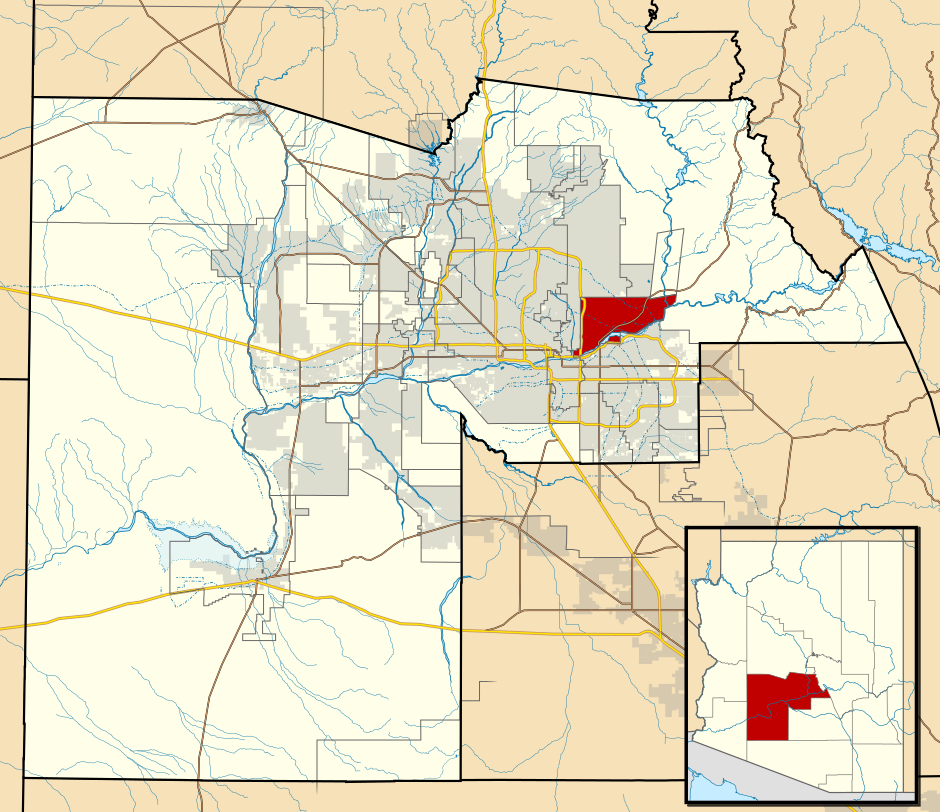
| Опис | This map shows the incorporated areas and Indian reservation boundaries in Maricopa County, Arizona, along with water bodies and major highways and roads. The Salt River Pima Maricopa Indian Community is highlighted in red. Other incorporated cities are shown in gray, planning area borders for these cities and Indian reservation borders are shown as solid black lines. Changes from Previous Version: Updated the maps to include water bodies and to make "less boring" than the plain black/white/gray maps. Format was updated to match standards laid out by WikiProject Maps/Conventions. Map data is based on data from the following Webpage: Maricopa County Interactive GIS Map. I created this map in Inkscape. |
| Час створення | |
| Джерело | My own work, based on government information |
| Автор | Ixnayonthetimmay |
| Ліцензія (Повторне використання цього файлу) |
Public Domain |
| Інші версії | See Category:Maps of Maricopa County for other versions of this image. |
Ліцензування
| Я, власник авторських прав на цю роботу, передаю роботу в суспільне надбання. Застосовується по всьому світу. У деяких країнах це не може бути юридично можливо, в такому випадку: Я даю кожному право на використання цієї роботи для будь-яких цілей, без будь-яких умов, якщо такі умови не вимагаються за законом. |
Історія файлу
Клацніть на дату/час, щоб переглянути, як тоді виглядав файл.
| Дата/час | Мініатюра | Розмір об'єкта | Користувач | Коментар | |
|---|---|---|---|---|---|
| поточний | 06:42, 20 травня 2011 | | 940 × 812 (1,05 МБ) | Ixnayonthetimmay | Uploading new version |
| 04:42, 30 серпня 2008 |  | 900 × 800 (413 КБ) | Ixnayonthetimmay | == Summary == {{Information |Description=This map shows the incorporated areas and unincorporated areas in Maricopa County, Arizona. [[:en:Sentinel, Arizona| | |
| 23:48, 15 вересня 2007 |  | 900 × 800 (385 КБ) | Ixnayonthetimmay | == Summary == {{Information |Description=This map shows the incorporated areas in Maricopa County, Arizona. It also shows the boundaries for the municipal planning areas. The [[:en:Fort | |
| 10:12, 28 травня 2007 |  | 900 × 780 (330 КБ) | Ixnayonthetimmay | ||
| 01:14, 22 травня 2007 |  | 900 × 780 (322 КБ) | Ixnayonthetimmay | ||
| 05:25, 30 січня 2007 |  | 904 × 758 (189 КБ) | Ixnayonthetimmay | {{Information |Description=This map shows the incorporated areas in Maricopa County, Arizona, highlighting [[:w:Salt River Pima Maricopa Indian Community|Salt River Pima Maricopa Indian |
Використання файлу
Така сторінка використовує цей файл:
Глобальне використання файлу
Цей файл використовують такі інші вікі:
- Використання в ar.wikipedia.org
- Використання в ca.wikipedia.org
- Використання в en.wikipedia.org
- Використання в fr.wikipedia.org