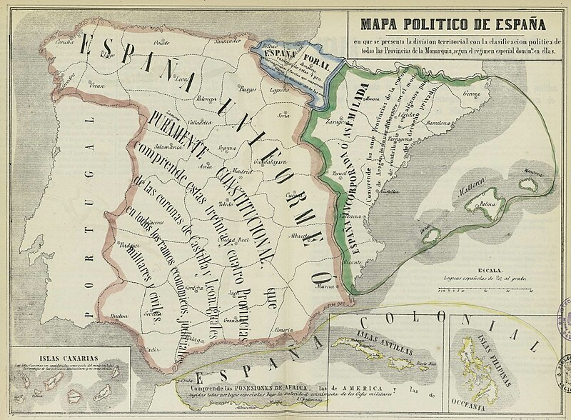
Файл:Mapa político de España, 1850.jpg
Перейти до навігації
Перейти до пошуку

Розмір при попередньому перегляді: 800 × 588 пікселів. Інші роздільності: 320 × 235 пікселів | 640 × 470 пікселів | 1024 × 752 пікселів | 1280 × 940 пікселів | 1800 × 1322 пікселів.
Повна роздільність (1800 × 1322 пікселів, розмір файлу: 399 КБ, MIME-тип: image/jpeg)
Історія файлу
Клацніть на дату/час, щоб переглянути, як тоді виглядав файл.
| Дата/час | Мініатюра | Розмір об'єкта | Користувач | Коментар | |
|---|---|---|---|---|---|
| поточний | 10:52, 23 листопада 2012 |  | 1800 × 1322 (399 КБ) | Ivan bea | Better resolution image of the same file |
| 16:23, 4 серпня 2006 |  | 800 × 595 (98 КБ) | Dodo | Political map of Spain in 1854 after the First Carlist War and the tax, legal system and military frontiers move to the Pyrenees, which resulted in the spreading of a sense of frustration among the Basques that led to another Carlist war and the subsequen |
Використання файлу
Такі сторінки використовують цей файл:
Глобальне використання файлу
Цей файл використовують такі інші вікі:
- Використання в an.wikipedia.org
- Використання в ar.wikipedia.org
- Використання в azb.wikipedia.org
- Використання в ca.wikipedia.org
- Espanya
- Història del País Valencià
- Corona d'Aragó
- Furs
- Espanyolisme
- Diada Nacional de Catalunya
- Anticatalanisme
- Història del dret català
- Nacionalitat històrica
- Cronologia de la repressió del català
- Sexenni Democràtic
- Història del nacionalisme basc
- Diada del 25 d'abril
- Estat nació
- Història de l'Aragó
- Regionalisme i nacionalisme a Espanya
- Història del País Basc
- Usuari:Coentor/25
- Història de l'organització territorial del poder a Espanya
- Використання в de.wikipedia.org
- Використання в en.wikipedia.org
- Catalan language
- History of Europe
- Nation state
- History of Catalonia
- Fuero
- Catalan independence movement
- First Carlist War
- User:Idiazabal
- Anti-Catalan sentiment
- History of the Basques
- 1833 territorial division of Spain
- Communities of chartered regime
- End of Basque home rule in Spain
- User:Ixtal/sandbox
- History of the territorial organization of Spain
- Використання в eo.wikipedia.org
- Використання в es.wikipedia.org
Переглянути сторінку глобального використання цього файлу.