Файл:United Kingdom United States Locator.svg
Перейти до навігації
Перейти до пошуку

Розмір цього попереднього перегляду PNG для вихідного SVG-файлу: 800 × 353 пікселів. Інші роздільності: 320 × 141 пікселів | 640 × 283 пікселів | 1024 × 452 пікселів | 1280 × 565 пікселів | 2560 × 1130 пікселів | 940 × 415 пікселів.
Повна роздільність (SVG-файл, номінально 940 × 415 пікселів, розмір файлу: 2,56 МБ)
| Відомості про цей файл містяться на Вікісховищі — централізованому сховищі вільних файлів мультимедіа для використання у проектах Фонду Вікімедіа. |
Опис файлу
| Опис |
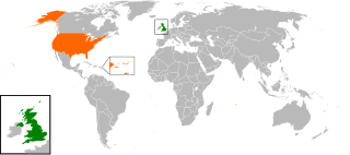
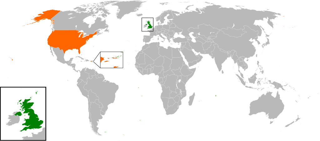
English: Map of the world showing the location of the United Kingdom and the United States of America. |
| Час створення | |
| Джерело | Власна робота |
| Автор | Jolly Janner |
Ліцензування
| Я, власник авторських прав на цю роботу, передаю роботу в суспільне надбання. Застосовується по всьому світу. У деяких країнах це не може бути юридично можливо, в такому випадку: Я даю кожному право на використання цієї роботи для будь-яких цілей, без будь-яких умов, якщо такі умови не вимагаються за законом. |
Історія файлу
Клацніть на дату/час, щоб переглянути, як тоді виглядав файл.
| Дата/час | Мініатюра | Розмір об'єкта | Користувач | Коментар | |
|---|---|---|---|---|---|
| поточний | 16:00, 20 березня 2017 | | 940 × 415 (2,56 МБ) | RaviC | add dependencies, inset map for Virgin Islands region where both states share a maritime border |
| 02:43, 24 грудня 2016 |  | 940 × 415 (1,79 МБ) | BurritoBazooka | put all Faroe islands except Suðuroy region behind black border of UK box. Make two boxes (transparent group rectangle and white bg rectangle) same stroke thickness. | |
| 00:43, 24 грудня 2016 |  | 940 × 415 (1,79 МБ) | BurritoBazooka | add France and Faroe Islands to UK box by re-cutting it from its place on the map (b/c why should ROI, another sovereign state, be shown, and not France and the Faroe Islands?) Also the box has its own group now. | |
| 00:34, 24 грудня 2016 |  | 940 × 415 (1,78 МБ) | BurritoBazooka | French Polynesia, Pitcairn Islands were showing in the UK box, but these are not in the same area as the British Isles at all. Also, are Falklands etc not on the same level as Puerto Rico? | |
| 18:38, 7 грудня 2016 |  | 940 × 415 (1,78 МБ) | Mikey641 | Accident | |
| 18:38, 7 грудня 2016 |  | 512 × 226 (753 КБ) | Mikey641 | -- | |
| 18:09, 3 березня 2013 |  | 940 × 415 (1,78 МБ) | Timothy Gu | +South Sudan (w/ small Britain map) | |
| 21:25, 2 березня 2012 |  | 940 × 415 (1,63 МБ) | Jrobin08 | Reverted to version as of 20:37, 24 June 2009 (Easier to see the United Kingdom. Maybe someone can add South Sudan to the map, but keep the UK zoom box in.) | |
| 21:05, 23 вересня 2011 |  | 940 × 415 (1,76 МБ) | Bazonka2 | + South Sudan | |
| 20:37, 24 червня 2009 |  | 940 × 415 (1,63 МБ) | Jolly Janner | {{Information |Description={{en|1=Map of the world showing the location of the United Kingdom and the United States of America.}} |Source=Own work by uploader |Author=Jolly Janner |Date=2009-0 |
Використання файлу
Така сторінка використовує цей файл:
Глобальне використання файлу
Цей файл використовують такі інші вікі:
- Використання в ar.wikipedia.org
- Використання в ca.wikipedia.org
- Використання в de.wikipedia.org
- Використання в en.wikipedia.org
- Використання в es.wikipedia.org
- Використання в fr.wikipedia.org
- Використання в he.wikipedia.org
- Використання в hy.wikipedia.org
- Використання в id.wikipedia.org
- Використання в it.wikipedia.org
- Використання в ja.wikipedia.org
- Використання в ps.wikipedia.org
- Використання в pt.wikipedia.org
- Використання в ru.wikipedia.org
- Використання в th.wikipedia.org
- Використання в tr.wikipedia.org
- Використання в www.wikidata.org
- Використання в zh.wikipedia.org