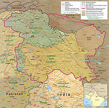
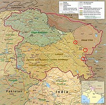
Файл:Kashmir Region November 2019.jpg
Перейти до навігації
Перейти до пошуку

Розмір при попередньому перегляді: 604 × 599 пікселів. Інші роздільності: 242 × 240 пікселів | 484 × 480 пікселів | 774 × 768 пікселів | 1033 × 1024 пікселів | 1579 × 1566 пікселів.
Повна роздільність (1579 × 1566 пікселів, розмір файлу: 1,44 МБ, MIME-тип: image/jpeg)
Історія файлу
Клацніть на дату/час, щоб переглянути, як тоді виглядав файл.
| Дата/час | Мініатюра | Розмір об'єкта | Користувач | Коментар | |
|---|---|---|---|---|---|
| поточний | 09:14, 2 червня 2022 |  | 1579 × 1566 (1,44 МБ) | Fowler&fowler | Reverted to version as of 04:58, 21 February 2022 (UTC) Again and for the last time, there is a WikiProjects India, Pakistan, and China consensus for this file to only appear in this form. It cannot be changed to highlight one portion or other for any of the subdivisions. If you persist, I will request administrative action |
| 14:44, 26 квітня 2022 |  | 1579 × 1566 (2,15 МБ) | Aréat | updated the key. What's the problem with the colors for the up to date situation? It's a public domain file | |
| 04:58, 21 лютого 2022 |  | 1579 × 1566 (1,44 МБ) | Fowler&fowler | Reverted to version as of 14:08, 4 January 2021 (UTC). Sorry by a WikiProjects India-Pakistan consensus we cannot change the CIA maps and its colors; see "Indian-administered" color map on the top right. | |
| 04:04, 6 квітня 2021 |  | 1579 × 1566 (2,09 МБ) | Aréat | Distinct colors for Ladakh and Jammu and Kashmir, sicne the map is used on their page, and the map as it was made it hard to see what their respective territory is | |
| 14:08, 4 січня 2021 |  | 1579 × 1566 (1,44 МБ) | Sbb1413 | Updated to include modern-day names of some provinces and states (e.g. North Western Frontier Province is now called Khyber Pakhtunkhwa, Uttaranchal is now called Uttarakhand). | |
| 06:13, 3 грудня 2020 |  | 1579 × 1566 (1,27 МБ) | Sbb1413 | Reverted to version as of 16:29, 25 November 2019 (UTC) | |
| 06:05, 3 грудня 2020 |  | 2469 × 2449 (1023 КБ) | Sbb1413 | Added working boundary from File:File:Kashmir map big.jpg, also from CIA. | |
| 16:29, 25 листопада 2019 |  | 1579 × 1566 (1,27 МБ) | Fowler&fowler | Moving labels to less cluttered spots; making Aksai Chin as big as other labels; drawing the J&K and Ladakh boundaries in green as indicated in info on the top left; making that info conform to the name change: Northern Areas-->Gilgit-Baltistan | |
| 06:29, 14 листопада 2019 |  | 1579 × 1567 (1,35 МБ) | Fowler&fowler | User created page with UploadWizard |
Використання файлу
Така сторінка використовує цей файл:
Глобальне використання файлу
Цей файл використовують такі інші вікі:
- Використання в ar.wikipedia.org
- Використання в as.wikipedia.org
- Використання в az.wikipedia.org
- Використання в ba.wikipedia.org
- Використання в bn.wikipedia.org
- Використання в ca.wikipedia.org
- Використання в de.wikipedia.org
- Використання в de.wikivoyage.org
- Використання в en.wikipedia.org
- Territorial dispute
- Line of Control
- Baltistan
- Line of Actual Control
- Skardu
- Trans-Karakoram Tract
- Talk:List of ongoing armed conflicts
- Dominion of India
- Kashgar Prefecture
- Frozen conflict
- History of Ladakh
- Talk:Robin Raphel
- Sino-Indian border dispute
- List of active separatist movements in Asia
- History of Azad Kashmir
- Jammu division
- Ministry of Kashmir Affairs and Gilgit-Baltistan
- Wikipedia talk:Noticeboard for India-related topics/Archive 69
- Talk:Ladakh/Archive 1
- Wikipedia talk:WikiProject Maps/Archive 2020
- User:DutchTreat/Projects/Maps
- Wikipedia:Noticeboard for Kashmir-related topics
- Portal:Kashmir
- Portal:Kashmir/Intro
- User talk:Kautilya3/Archives/Archive 17
- Talk:Azad Kashmir/Archives/2021
- Talk:Jammu and Kashmir (union territory)/Archive 1
Переглянути сторінку глобального використання цього файлу.


