Файл:Un-senegal.png
Повна роздільність (3092 × 2367 пікселів, розмір файлу: 2,74 МБ, MIME-тип: image/png)
| Відомості про цей файл містяться на Вікісховищі — централізованому сховищі вільних файлів мультимедіа для використання у проектах Фонду Вікімедіа. |
Опис файлу
| Опис |
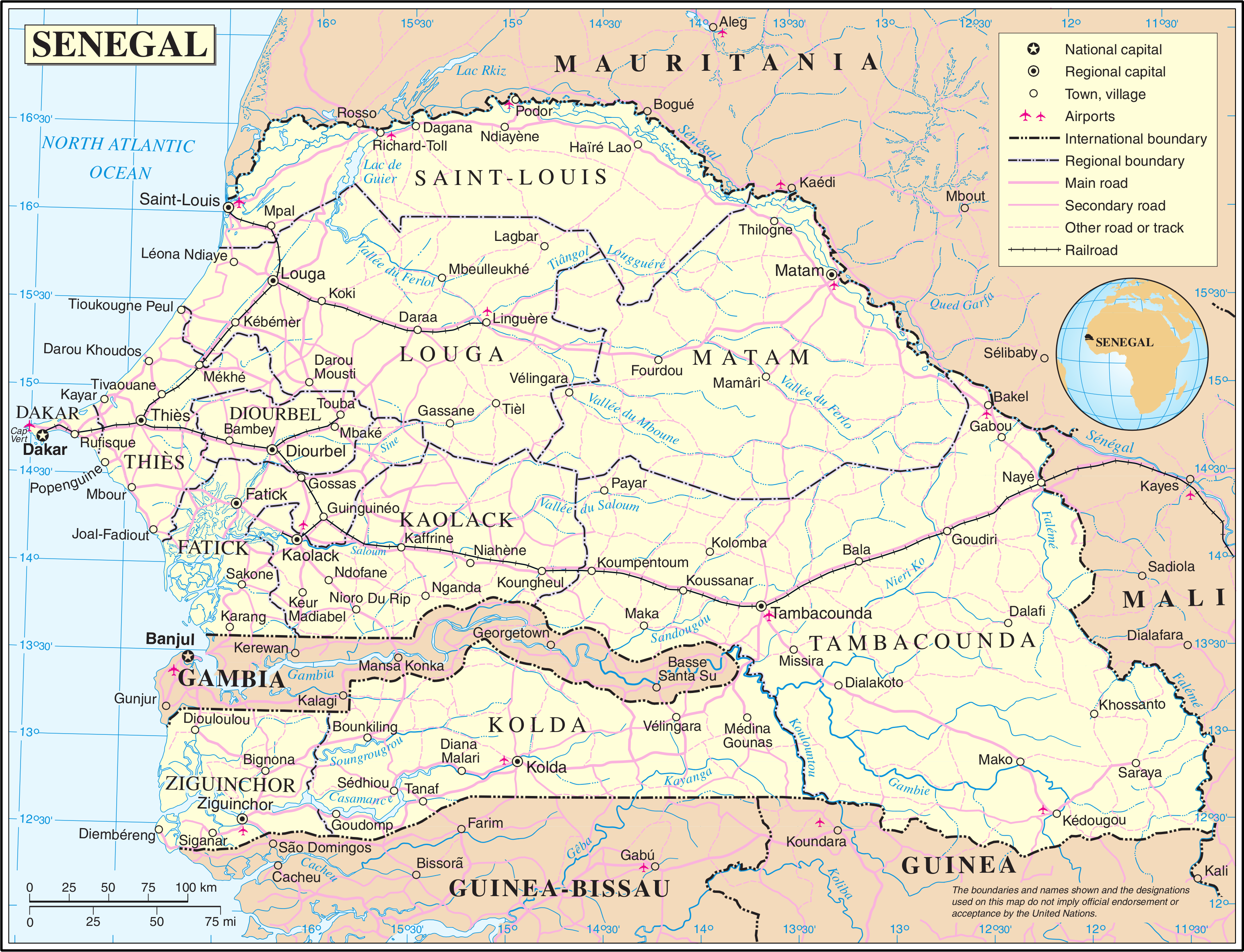
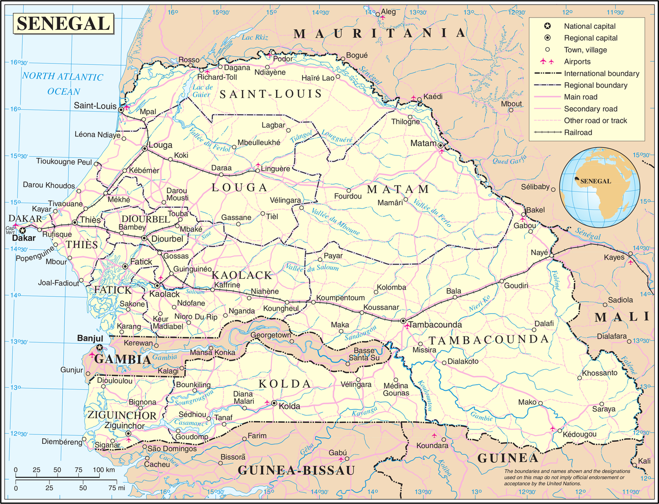
English: Administrative map of the 11 former regions of Senegal from 21 February 2002 to 10 september 2008, before the separation of the three new regions of Kédougou (from the region of Tambacounda), Sédhiou (from the region of Ziguinchor) and Kaffrine (from the region of Kaolack). Français : Carte administrative des 11 anciennes régions du Sénégal du 21 février 2002 au 10 septembre 2008, avant la séparation des trois nouvelles régions de Kédougou (de la région de Tambacounda), Sédhiou (de la région de Ziguinchor) et Kaffrine (de la région de Kaolack). |
| Час створення | |
| Джерело | Based on a reference map created in 2004 by the United Nations and published in PDF format. |
| Автор | Original by the United Nations. Cropped as required by the licence to derive a PNG version. |
Ліцензування
| This image is a map derived from a United Nations map.
Unless stated otherwise, UN maps are to be considered in the public domain. This applies worldwide. UN maps are, in principle, open source material and you can use them in your work or for making your own map. UN requests however that you delete the UN name, logo and reference number upon any modification to the map. Content of your map will be your responsibility. You can state in your publication, if you wish, something like: based on UN map … (map name, map number, revision number and date). See: Geospatial Information Section. And: Geospatial, location data for a better world. |
 |
Історія файлу
Клацніть на дату/час, щоб переглянути, як тоді виглядав файл.
| Дата/час | Мініатюра | Розмір об'єкта | Користувач | Коментар | |
|---|---|---|---|---|---|
| поточний | 02:13, 24 жовтня 2007 | | 3092 × 2367 (2,74 МБ) | Jeroen | {{UN map}} Category:Maps of Senegal |
Використання файлу
Такі сторінки використовують цей файл:
Глобальне використання файлу
Цей файл використовують такі інші вікі:
- Використання в az.wikipedia.org
- Використання в en.wikipedia.org
- Використання в es.wikipedia.org
- Використання в eu.wikipedia.org
- Використання в fr.wikipedia.org
- Використання в it.wikipedia.org
- Використання в nl.wikipedia.org
- Використання в pl.wiktionary.org
- Використання в wo.wikipedia.org
- Використання в zh-yue.wikipedia.org