Файл:Song Dynasty Map.JPG

Матеріал з Вікіпедії — вільної енциклопедії.
Перейти до навігації Перейти до пошуку

Повна роздільність (756 × 768 пікселів, розмір файлу: 436 КБ, MIME-тип: image/jpeg)

Info

Опис

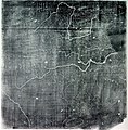
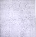
The Chinese Yu Ji Tu (Map of the Tracks of Yu the Great), a map carved into stone in the year 1137 during the Song Dynasty, located in the Stele Forest of modern-day Xian, China. Yu the Great refers to the Chinese deity described in the Chinese geographical work of the Yu Gong, a chapter of the Classic of History. Needham and Chavannes assert that the original map must have predated the 12th century.

The graduated scale of this gridded map is at 100 li (Chinese mile) squared for every representative square in the grid. The overall size of the map is 3 ft squared. The coastal outline is relatively firm and the precision of the network of river systems is incredibly accurate. The name of the geographers and cartographers who initially created the map are unknown. In the year 1142 a copy of the map was preserved at Zhenjiang in Jiangsu province by a certain Yu Chi, who was then a Prefectural Director of Studies. There is also mention of an earlier copy of about 1100 AD which itself was based on the Chang'an version. Needham asserts that the map was used primarily to instruct students while referring to sites described in the ancient Yu Gong chapter of the Classic of History.
Час створення printing of a rubbing of a c. 1136 engraving of a c. 1100 map
Джерело Joseph Needham's Science and Technology in China, Vol. 3: Mathematics and the Sciences of the Heavens and the Earth, Plate LXXXI and text description pp. 547–549, hardback edition
Автор Unknown, photo by PericlesofAthens


Public domain

Ця робота перебуває у суспільному надбанні у країнах і територіях, де авторське право охороняється протягом життя автора та 70 років після того або менше.


Ви також мусите включити позначку про суспільне надбання США, аби пояснити чому ця робота є у суспільному надбанні у США.
Цей файл визнано вільним від відомих обмежень з боку закону про авторські права, включаючи всі пов'язані і суміжні права.

Public domain Я, власник авторських прав на цю роботу, передаю роботу в суспільне надбання. Застосовується по всьому світу.
У деяких країнах це не може бути юридично можливо, в такому випадку:
Я даю кожному право на використання цієї роботи для будь-яких цілей, без будь-яких умов, якщо такі умови не вимагаються за законом.

Підписи

Додайте однорядкове пояснення, що саме репрезентує цей файл

Об'єкти, показані на цьому файлі

зображує

Yujitu англійська

Історія файлу

Клацніть на дату/час, щоб переглянути, як тоді виглядав файл.

Дата/часМініатюраРозмір об'єктаКористувачКоментар
поточний07:25, 3 серпня 2011Мініатюра для версії від 07:25, 3 серпня 2011756 × 768 (436 КБ)Dragonet~commonswikibetter quality
10:32, 3 листопада 2007Мініатюра для версії від 10:32, 3 листопада 2007834 × 843 (89 КБ)PericlesofAthens{{Information |Description=The Chinese ''Yu Ji Tu'' (Map of the Tracks of Yu the Great), a map carved into stone in the year 1137 during the Song Dynasty, located in the Stele Forest of modern-day Xian, China. Yu the Great refers to the Chinese deity desc

Така сторінка використовує цей файл:

Глобальне використання файлу

Цей файл використовують такі інші вікі:

Метадані